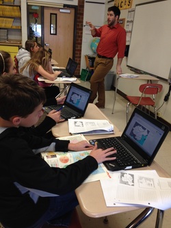
Today I had the pleasure of "teaming up" with a Glen Meadow social studies teacher, Greg Jablonski, to introduce a unit on Asian civilizations. A traditional colored-pencil and paper activity was replaced with a collaborative digital mapping effort through Google Drawing. A blank map of China was "shared" out to the class and students were given a list of geographical items to locate and map.
Pairs of students used the features of Google Drive to work together synchronously on a single map, while Google Drawing provided graphical editing tools such as shapes and text boxes.
Students polished their shared maps with self-made symbolic legends. The products of the activity were unique, cloud-stored and collaborative. The students are looking forward to continuing this effort as they explore the same regions in Google Earth and embed screenshots into their maps.
 RSS Feed
